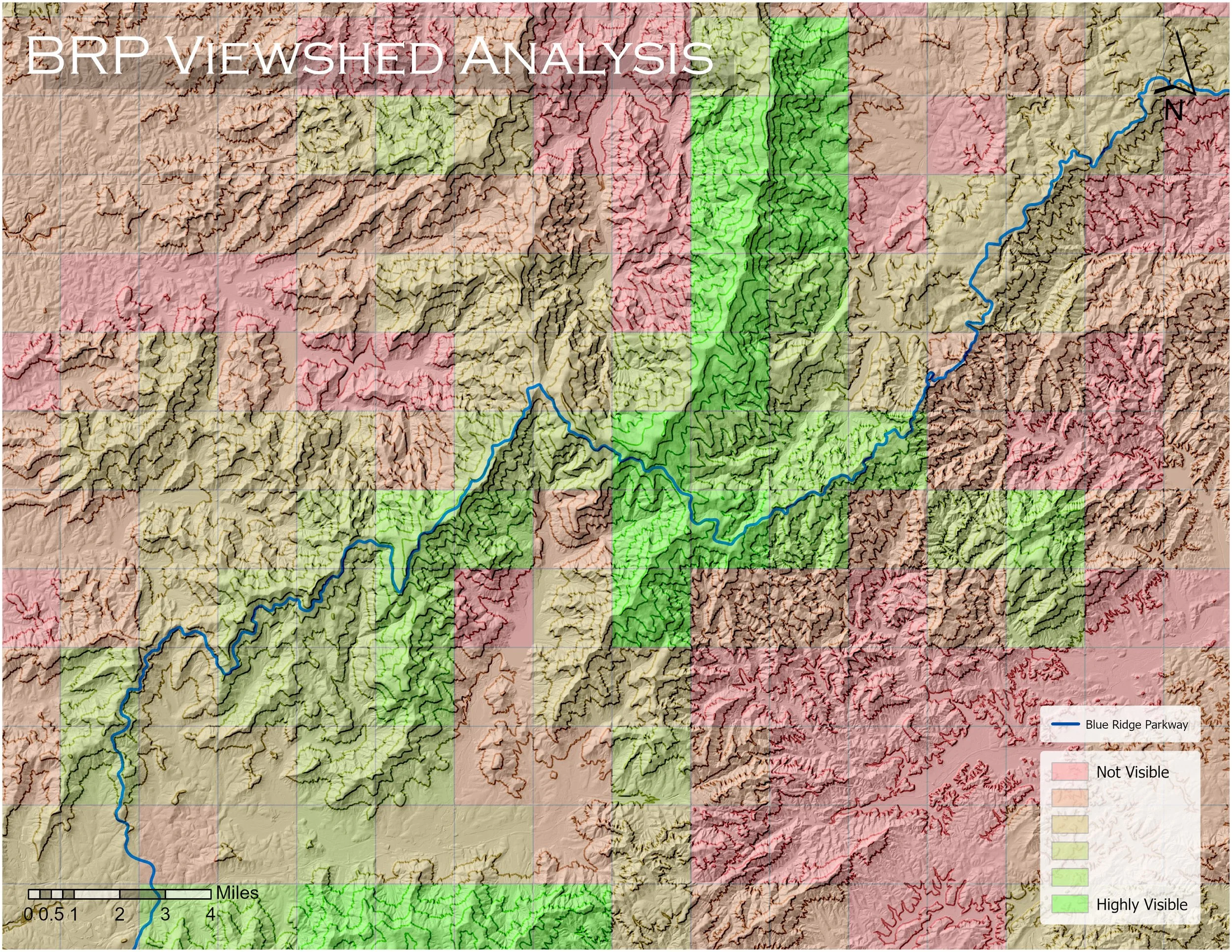
LiDAR & Complex Analysis

The Basics
These basic LiDAR-based analyses can be customized in their delineation, visualization, and symbology, which can be exported as packaged layers or georeferenced, field-ready maps. This data can be also used as a variable in more complex analyses across a wide variety of applications and help tell detailed stories of the landscape.
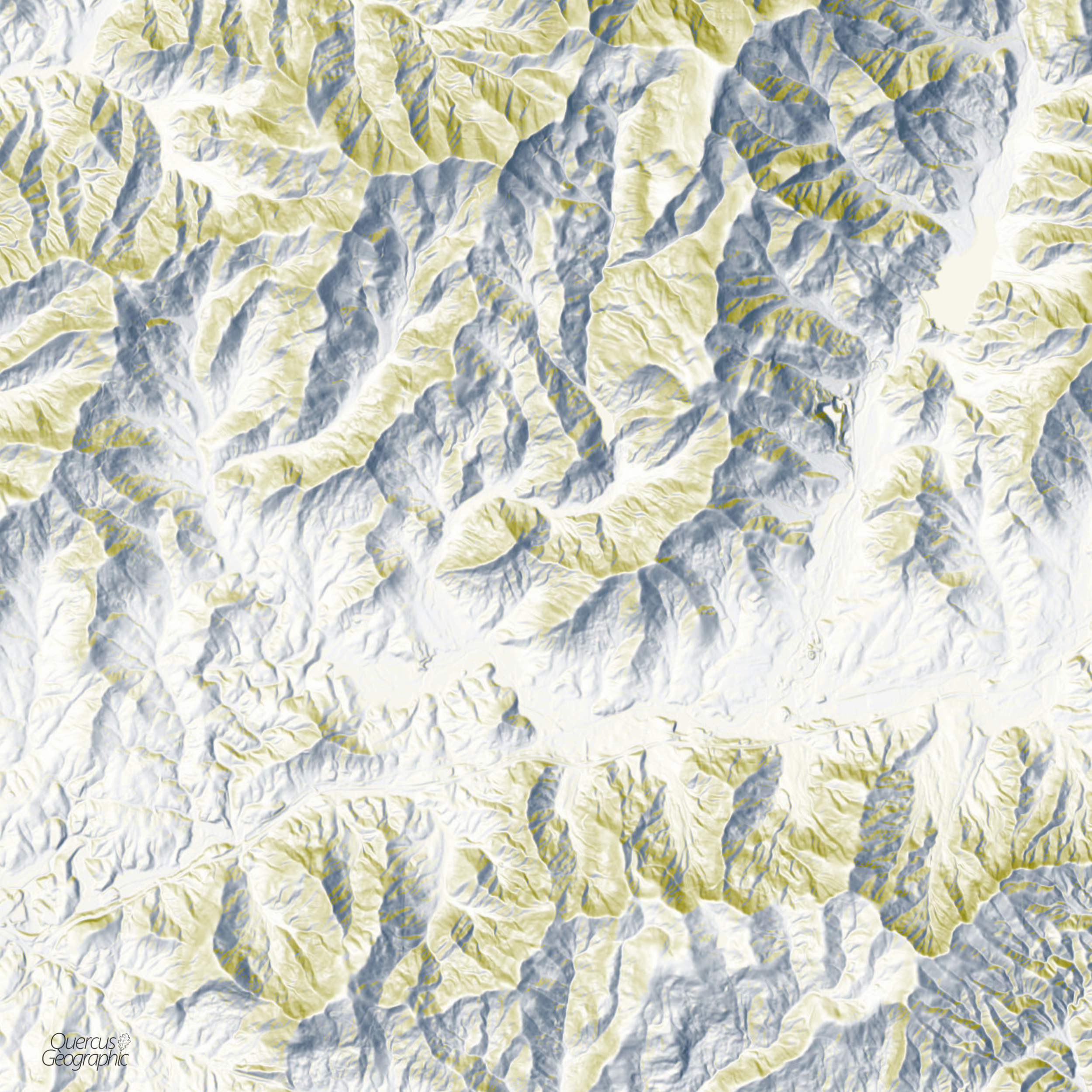
Also, it looks really cool!
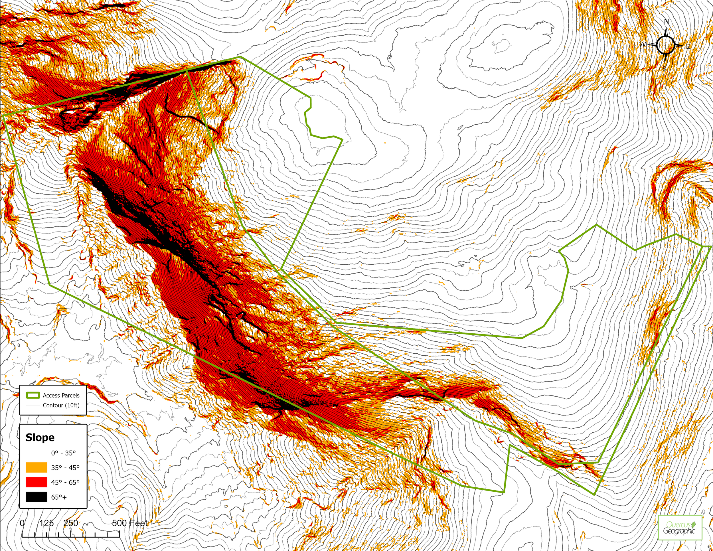
Slope Analysis
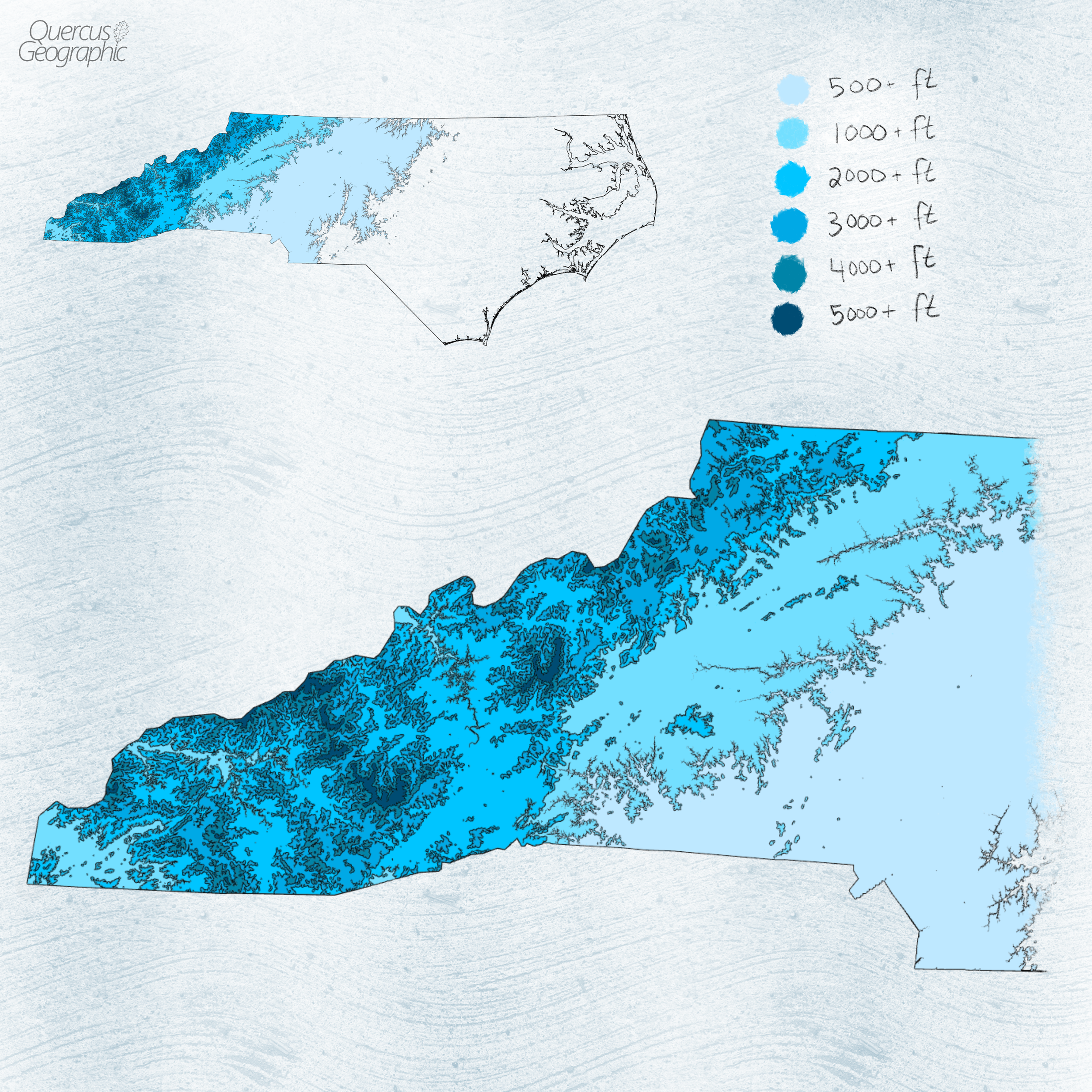
Elevation Analysis
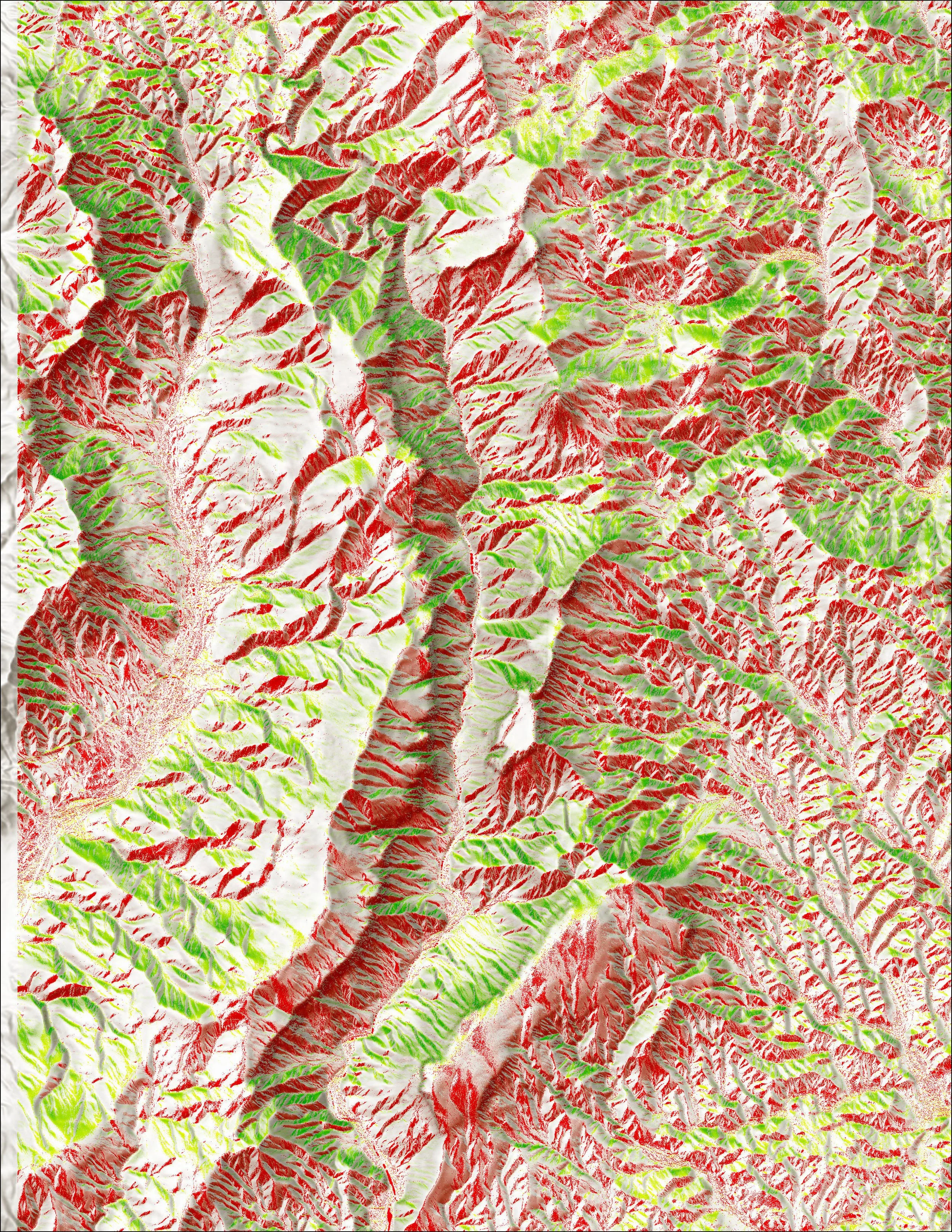
Aspect Analysis
Interested in working with QG?
Please submit a Contact form to discuss rates and project details, or to ask general questions.
You can also email me directly at quercusgeographic@gmail.com